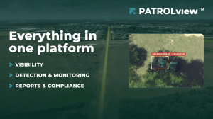
Anticipate. Rank. Safeguard. An aerial intelligence system designed for pipeline right-of-way choices — merging patrol, threat monitoring, leak detection, visuals, and DOT conformance.
PatrolView™ goes beyond being just another dataset that operators must sort through. Our approach transforms isolated information sources into actionable steps: anticipate, rank, safeguard.”— Kris Covey, VP, Oil & Gas, Forsite
Forsite has unveiled PatrolView™, a consolidated aerial intelligence service that combines hazard identification, liquid and methane leak surveillance, high-definition imagery, vegetation scheduling, and DOT adherence into one platform-based offering. PatrolView™ is currently operational with various pipeline companies throughout North America.
Built on more than 85 years of airborne inspection experience, PatrolView™ leverages Forsite’s operational base: 2.2 million miles of DOT-required patrols each year, over 70 pipeline operators — including some of the largest interstate transmission and midstream firms in North America — and 22 aviation hubs. The system allows a compact right-of-way crew to oversee a continent-wide infrastructure.
“Pipeline operators have historically managed patrol, threat detection, leak monitoring, compliance, and vegetation as separate programs. PatrolView™ brings them into one offering. We risk-rank threats and third-party activity, surface leading indicators alongside critical issues, and give operators one place to see site changes and aerial intelligence flight over flight.”
— Kris Covey, VP, Oil & Gas, Forsite
A number of PatrolView™’s detection features are provided through Forsite’s tech collaboration with Flyscan Systems Inc., demonstrating Forsite’s strategy of incorporating top-tier technology within a unified system.
Features integrated into the PatrolView™ offering:
• Automated AI threat detection across 11 categories — large machinery, uncovered pipe, soil disruption, unauthorized access. Detections are ranked by risk level and assigned geographic coordinates.
• Liquid hydrocarbon leak identification Hyperspectral technology detects gradual leaks and seepage below what control-center monitoring can identify.
• Methane leak identification with quick processing. Emission maps, GPS-linked maximum concentration points, and wind data embedded within PatrolView™ for comparing data across flights.
• High-definition imagery captured on every mile of each flight. Multi-year historical records, change detection between passes, and an up-to-date base map accessible in ArcGIS or PatrolView™.
• Automated patrol documentation and DOT compliance monitoring — every mission recorded, prepared for audits. Flight logs generate the evidence operators need for DOT and PHMSA evaluations.
• Predictive threat assessment combining past detection data, image comparison, and location details to spot early warnings before they worsen.
• Vegetation management scheduling multi-year, system-wide clearing strategies adjusted for growth rates, site access, and regulatory requirements.
• LiDAR information gathering for geological risks (separate flight) for later evaluation by the operator’s engineering team.
PatrolView™ is adaptable. Operators can select threat detection, leak surveillance, vegetation planning, LiDAR, or the complete system — and can implement them step by step. Forsite can serve as the patrol provider or connect PatrolView™ with an operator’s current patrol service and information, without interfering with existing partnerships. The system integrates into the operator’s ArcGIS environment or functions as a separate dashboard.
“PatrolView™ goes beyond being just another dataset that operators must sort through. Our approach transforms isolated information sources into actionable steps: anticipate, rank, safeguard.”
— Kris Covey, VP, Oil & Gas, Forsite
The system merges multipurpose sensor packages (hyperspectral, optical, and laser-based tools) with over 30 million training images and a workforce of more than 400 former pipeline operators, remote sensing experts, patrol aviators, geospatial analysts, and natural resource specialists.
View active threats, leak records, compliance documentation, and historical changes across your pipeline network. Arrange a demonstration at forsitegeo.com/patrolview.
ABOUT FORSITE
Forsite operates as a geospatial intelligence firm supporting pipeline companies, utilities, energy enterprises, forest managers, and government bodies throughout North America. The organization unites aerial LiDAR, pipeline surveillance, wildfire expertise, professional forestry, and environmental analysis under a single structure, delivering the full operational perspective that decisions rely on. Forsite manages the sector’s most extensive dedicated pipeline patrol network and has captured high-density LiDAR across 1.9 million square miles of North America. Additional details can be found at forsitegeo.com.
ABOUT FLYSCAN
Flyscan Systems Inc. stands as the world’s pioneer in enabling liquid hydrocarbon detection plus automation of Right-of-Way visual inspection using standard regulatory patrol aircraft. Through remote sensing and artificial intelligence, and now also providing natural gas leak detection, the company’s aim is to assist energy firms and all operators of lengthy linear critical infrastructure in better safeguarding their assets, the public, and the environment while achieving a positive financial outcome.
Sara Braun
Forsite
corpmarketing@forsitegeo.com
Visit us on social media:
LinkedIn
YouTube